![](/images/other/stat-length.png)
![Trail On foot Holzhausen an der Haide - Rundwanderweg Holzhausen 2 - Photo](https://media.geolcdn.com/t/1900/400/58100c93-e028-4866-9c46-b615addaa806.jpeg&format=pjpeg&maxdim=2)
Rundwanderweg Holzhausen 2
SityTrail - itinéraires balisés pédestres
Tous les sentiers balisés d’Europe GUIDE+
![Length](/images/other/stat-length.png)
Length
3.5 km
![Max alt](https://static1.geolcdn.com/siteimages/upload/files/1508320355ic_sort_altitude_max_24dp.png)
Max alt
387 m
![Uphill gradient](https://static1.geolcdn.com/siteimages/upload/files/1508320355ic_sort_den_pos_24dp.png)
Uphill gradient
57 m
![Km-Effort](/images/other/stat-length.png)
Km-Effort
4.4 km
![Min alt](https://static1.geolcdn.com/siteimages/upload/files/1508320355ic_sort_altitude_min_24dp.png)
Min alt
299 m
![Downhill gradient](https://static1.geolcdn.com/siteimages/upload/files/1508320355ic_sort_den_neg_24dp.png)
Downhill gradient
98 m
![Boucle](https://static1.geolcdn.com/siteimages/upload/files/16400158638029165_repeat_loop_refresh_sync_direction_icon.png)
Boucle
No
Signpost
Creation date :
2022-02-11 16:20:54.838
Updated on :
2022-02-11 16:20:54.838
![On foot](https://static1.geolcdn.com/sitytour/trail-icons/100.png)
1h00
Difficulty : Easy
![Scan this QR Code to open this trail in the SityTrail application](https://capi.geolives.com/qq0zvz2zws4bq2lad0pu/sitytour/trails/3096182/qr.png?size=200)
FREE GPS app for hiking
About
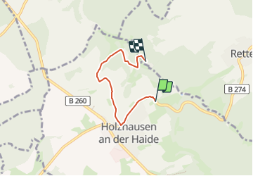
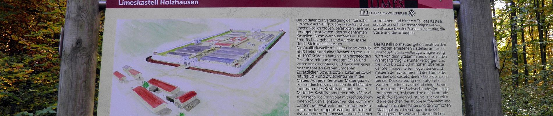
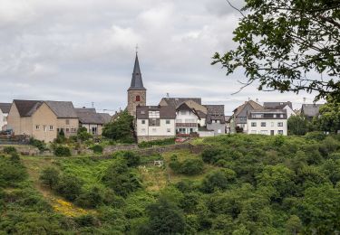
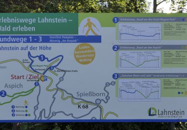
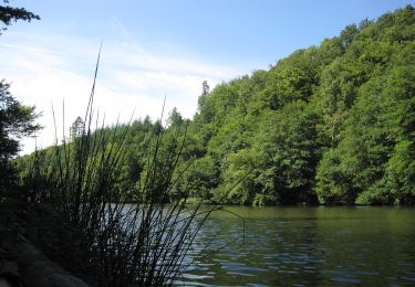
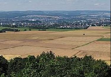
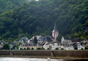
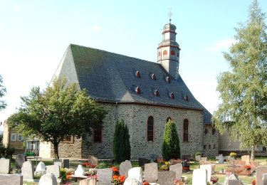
Trail On foot of 3.5 km to be discovered at Rhineland-Palatinate, Rhein-Lahn-Kreis, Holzhausen an der Haide. This trail is proposed by SityTrail - itinéraires balisés pédestres.
Description
Trail created by ?.
Symbol: schwarz "H2" auf weißem Schild
Positioning
Country:
Germany
Region :
Rhineland-Palatinate
Department/Province :
Rhein-Lahn-Kreis
Municipality :
Holzhausen an der Haide
Location:
Unknown
Start:(Dec)
Start:(UTM)
422754 ; 5564083 (32U) N.
Comments
Trails nearby
![Trail On foot Heidenrod - Dickschieder Wildwechsel - Photo](https://media.geolcdn.com/t/375/260/1317a9d5-9d72-4b1c-b97f-77cebb4d5d55.jpeg&format=jpg&maxdim=2)
![On foot On foot](https://static1.geolcdn.com/sitytour/trail-icons/100.png)
Dickschieder Wildwechsel
On foot
Easy
Heidenrod,
Hesse,
Rheingau-Taunus-Kreis,
Germany
![](/images/other/stat-length.png)
9.9 km | 13.8 km-effort
3h 7min
![](https://static1.geolcdn.com/siteimages/upload/files/16400158638029165_repeat_loop_refresh_sync_direction_icon.png)
No
![Trail On foot Geisenheim - Himmelssteig Stephanshausen - Photo](https://media.geolcdn.com/t/375/260/9223db67-e7da-4277-bf63-0b96616ead54.jpeg&format=jpg&maxdim=2)
![On foot On foot](https://static1.geolcdn.com/sitytour/trail-icons/100.png)
Himmelssteig Stephanshausen
On foot
Easy
Geisenheim,
Hesse,
Rheingau-Taunus-Kreis,
Germany
![](/images/other/stat-length.png)
11.2 km | 15.7 km-effort
3h 34min
![](https://static1.geolcdn.com/siteimages/upload/files/16400158638029165_repeat_loop_refresh_sync_direction_icon.png)
Yes
![Trail On foot Patersberg - Rheinsteig-Zuweg Reichenberg - Photo](https://media.geolcdn.com/t/375/260/218cc5e6-bd20-4d49-9cb7-475262efda6d.jpeg&format=jpg&maxdim=2)
![On foot On foot](https://static1.geolcdn.com/sitytour/trail-icons/100.png)
Rheinsteig-Zuweg Reichenberg
On foot
Easy
Patersberg,
Rhineland-Palatinate,
Rhein-Lahn-Kreis,
Germany
![](/images/other/stat-length.png)
3.6 km | 4.4 km-effort
1h 0min
![](https://static1.geolcdn.com/siteimages/upload/files/16400158638029165_repeat_loop_refresh_sync_direction_icon.png)
No
![Trail On foot Sankt Goarshausen - Rheinsteig-Zuweg Nochem - Photo](https://media.geolcdn.com/t/375/260/3f5191fc-70ef-45e0-a9cd-2f36cd7a53a2.jpeg&format=jpg&maxdim=2)
![On foot On foot](https://static1.geolcdn.com/sitytour/trail-icons/100.png)
Rheinsteig-Zuweg Nochem
On foot
Easy
Sankt Goarshausen,
Rhineland-Palatinate,
Rhein-Lahn-Kreis,
Germany
![](/images/other/stat-length.png)
3.8 km | 4.5 km-effort
1h 1min
![](https://static1.geolcdn.com/siteimages/upload/files/16400158638029165_repeat_loop_refresh_sync_direction_icon.png)
No
![Trail On foot Lahnstein - Rheinsteig-Exkursion Spießborner Grillhütte - Photo](https://media.geolcdn.com/t/375/260/b2377cd6-e4ec-4606-b2af-383b46dde74f.jpeg&format=jpg&maxdim=2)
![On foot On foot](https://static1.geolcdn.com/sitytour/trail-icons/100.png)
Rheinsteig-Exkursion Spießborner Grillhütte
On foot
Easy
Lahnstein,
Rhineland-Palatinate,
Rhein-Lahn-Kreis,
Germany
![](/images/other/stat-length.png)
3.8 km | 4.8 km-effort
1h 5min
![](https://static1.geolcdn.com/siteimages/upload/files/16400158638029165_repeat_loop_refresh_sync_direction_icon.png)
No
![Trail On foot Heidenrod - Naurother Grubengold - Photo](https://media.geolcdn.com/t/375/260/ec400498-09c2-4027-a72a-02659a5d515d.jpeg&format=jpg&maxdim=2)
![On foot On foot](https://static1.geolcdn.com/sitytour/trail-icons/100.png)
Naurother Grubengold
On foot
Easy
Heidenrod,
Hesse,
Rheingau-Taunus-Kreis,
Germany
![](/images/other/stat-length.png)
13.7 km | 18.8 km-effort
4h 16min
![](https://static1.geolcdn.com/siteimages/upload/files/16400158638029165_repeat_loop_refresh_sync_direction_icon.png)
Yes
![Trail On foot Limburg a. d. Lahn - Südroute Limburg - Photo](https://media.geolcdn.com/t/375/260/9b48fb64-2330-4cb9-82e9-adc99cc19a96.jpeg&format=jpg&maxdim=2)
![On foot On foot](https://static1.geolcdn.com/sitytour/trail-icons/100.png)
Südroute Limburg
On foot
Easy
Limburg a. d. Lahn,
Hesse,
Landkreis Limburg-Weilburg,
Germany
![](/images/other/stat-length.png)
11.8 km | 14 km-effort
3h 10min
![](https://static1.geolcdn.com/siteimages/upload/files/16400158638029165_repeat_loop_refresh_sync_direction_icon.png)
No
![Trail On foot Boppard - Traumschleife Rheingold - Photo](https://media.geolcdn.com/t/375/260/8437e446-2f43-4571-a9e9-1985d3cf142a.jpeg&format=jpg&maxdim=2)
![On foot On foot](https://static1.geolcdn.com/sitytour/trail-icons/100.png)
Traumschleife Rheingold
On foot
Easy
Boppard,
Rhineland-Palatinate,
Rhein-Hunsrück-Kreis,
Germany
![](/images/other/stat-length.png)
11 km | 15.8 km-effort
3h 35min
![](https://static1.geolcdn.com/siteimages/upload/files/16400158638029165_repeat_loop_refresh_sync_direction_icon.png)
Yes
![Trail On foot Lorch - Ranseler Höhenrausch - Photo](https://media.geolcdn.com/t/375/260/f828ac28-bdce-45ca-beb8-08b395de0ada.jpeg&format=jpg&maxdim=2)
![On foot On foot](https://static1.geolcdn.com/sitytour/trail-icons/100.png)
Ranseler Höhenrausch
On foot
Easy
Lorch,
Hesse,
Rheingau-Taunus-Kreis,
Germany
![](/images/other/stat-length.png)
10.5 km | 14 km-effort
3h 10min
![](https://static1.geolcdn.com/siteimages/upload/files/16400158638029165_repeat_loop_refresh_sync_direction_icon.png)
Yes